


If there was not a difficult section after the village of Kuti, this would be a tour suitable for everyone, since the ride in the rest of the route is pleasant and does not require any special effort. But to reach Gusinje one has to get up an extreme ascent after Kuti, and then there is a demanding descent on the other side as well. However, considering that the valley in which Kuti is located is one of the loveliest places in the area, we recommend riding at least to that little village. Then those who do not feel like sweating a lot may return to Andrijevica along the road they have used for coming here, whereas lovers of challenges may venture into an unforgettable ride towards Grnčar and Gusinje over the high ridge of Mt. Lipovica.
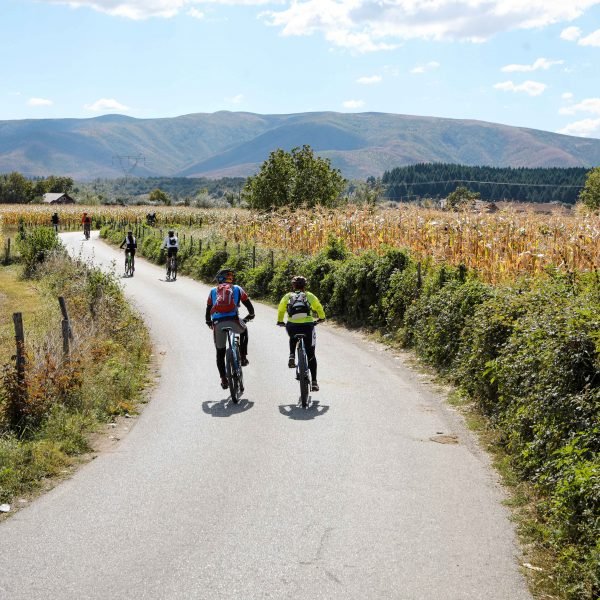
Near the centre of Andrijevica there is a junction at which we turn right. This quiet asphalt road will soon take us across the River Zlorečica, and right after that we come across two closely located junctions. At the first one, the road leading from the main road comes from the left, and at the second one, the old road to Kuti forks to the left and uphill, however we should continue straight on and along the flat ground.
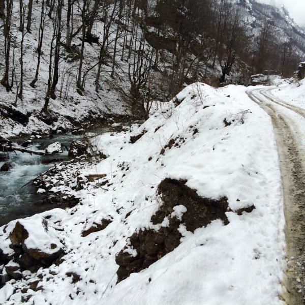
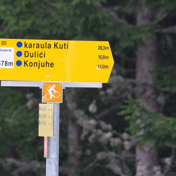
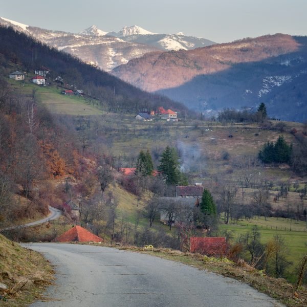
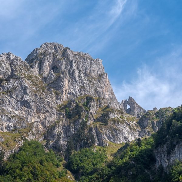
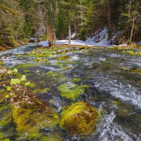
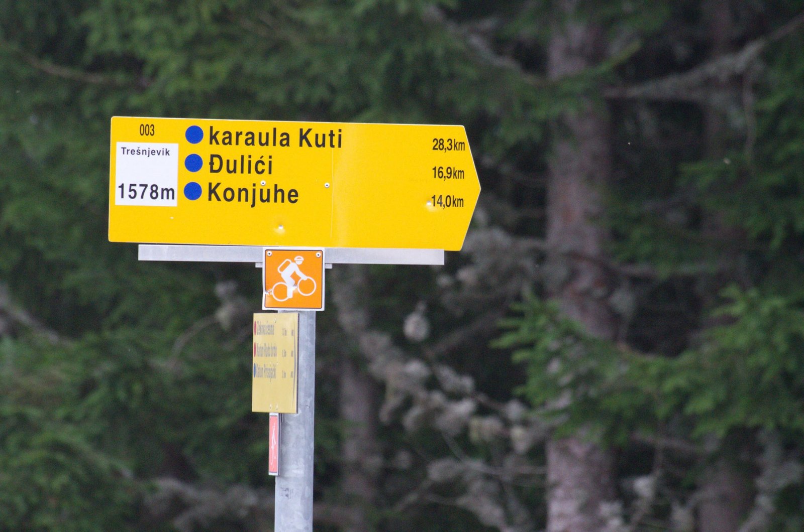
5.7km from the start, we reach a v-shape junction: the right road descends to the village of Đulići, whereas the left fork with an asphalt surface leads us to Kuti. At 9.6km a spring called Miloševa voda (Miloš’ s water) is located (on the left). From here the valley becomes quite narrow and the road winds below the crags, through a rich greenery and with the murmur of the rapids of the Kutska rijeka (River Kuti), known also as River Kuckaja. The silence and serenity present here are absorbed into our hair and clothes, so we will probably start to ride slower and slower… At the fourteen-kilometre point the valley widens on the left side, and we will see a little paradise Swiss-style: a bright shiny grassy carpet on the pastures, and on the carpet, furniture made up of several old cottages, here and there the occasional cow (no less photogenic than those from the Milka chocolate commercials, just waiting for someone to spot their talent) and above all that, like a hat, the grey peaks of Mt. Zeletin.
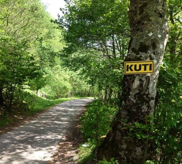
At 16.7km we reach the Kuti border watchtower, and soon after it the asphalt ends – from there we follow a steep trail leading to Lipovica. The elevation gain which one has to cover in the next two and a half kilometres is 450m (from an elevation of 1,040m we climb to 1,490m). Those fit enough will be able to ride along a good portion of the trail, but most cyclists will mainly want to push their bikes up this ascent. So, one should arm oneself with patience and plan enough time for this tour – then one can progress slowly and without any anxiety, with frequent breaks, and the ascent will “melt away” rather nicely. (The decision itself to head uphill is actually the hardest step towards the pass.)
We follow the forest trail which, in some stretches, could be called a footpath as well, and it serves as a patrol route for the border police.
The ascent ends 19.3km from the start and at an elevation of 1,490m. On the right, about 50m away, the B-11 border stone is located, and in front of us in the distance one can see the peaks above the Grebaja Valley of Karanfili Peak and Trojan Peak. The left fork at this junction is a grassy footpath which goes gently uphill, and we will follow the right fork, which immediately goes downhill. On the steep descent we will encounter a fantastic atmosphere of beech forest along which we will slide down on a wonderful carpet made of leaves, so this section is definitely one of the loveliest on this tour. But one should always keep in mind that this carpet, in certain places so thick that it resembles a snowdrift, hides within itself dead branches, stumps, stones and other obstacles which may cause us in an instant find ourselves lying on the ground. Therefore, for those who do not have sufficient experience or a bike suitable for these conditions it would be best to ride very slowly or to get off the bike – even then this will be a very nice experience.
After passing along the edge of the spacious Lipovačka livada (Lipovica Meadow) we will reach the first house in Bojovići, and then, 22.6km from the start and at an elevation of 960m above sea level, we join the asphalt road which leads from Gusinje towards the Grnčar border crossing. The elevation loss in relation to the point from which we start the descent (at the B-11 border stone) is 530m.
For fit cyclists, it will take about an hour and a half to complete the section from the Kuti border watchtower to the saddle; others should allow about an additional hour. The descent will take (somewhat unusually) nearly the same time, unless we are skilled in off-road riding. All in all, depending on one’s fitness level and skill, it takes between two and a half and five hours, excluding a possible lunch break or a longer rest break, to ride about 6km from the border watchtower to the road to Gusinje.
For Gusinje we will turn left (the right fork goes towards the border crossing located only a few hundred metres away). The asphalt gently descends and after we pass the hamlets of Radončići and Derviševići, we will soon reach that little town.
(Those who have enough time and the will to do it may want to continue from Grnčar along the second half of the easy macadam route GU 01. The mileage will not be much greater, only in this case we will ride the next 3km along a poor macadam road and a path through a field).

