


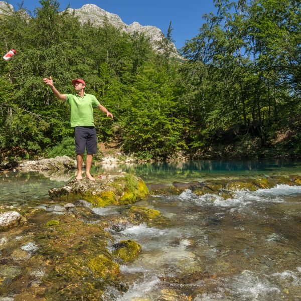
This is a really lovely, yet not too difficult, tour suitable for everyone who rides a bike relatively regularly, even if these are quite easy rides. The Ropojana Valley belongs at the top of the list of natural beauties in the region of Plav and Gusinje and is a pleasure we should definitely indulge in. Besides, without a visit to Ropojana our stay in this magical world on the northern side of Prokletije would not be complete …so let us venture forth through another valley which has a secret to reveal…
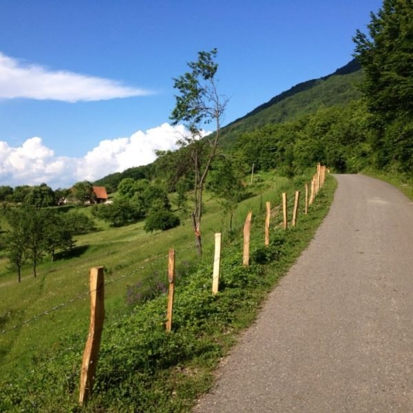
Slightly more than 500m from the start in the centre of Gusinje, we come across a junction at which we turn right, towards Ali Pasha’ s Springs. About 800m further on (1.4km from the start) there is a junction at which one should turn right for Ali Pasha’s Springs – this time we will not go there (Route GU 04), instead, we proceed left, through a green and lovely plain along which the River Vruja lounges. Soon we cross over it, and then head along the bank of the other local beauty, the River Grlja – a section for some laid-back enjoyment.
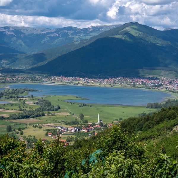
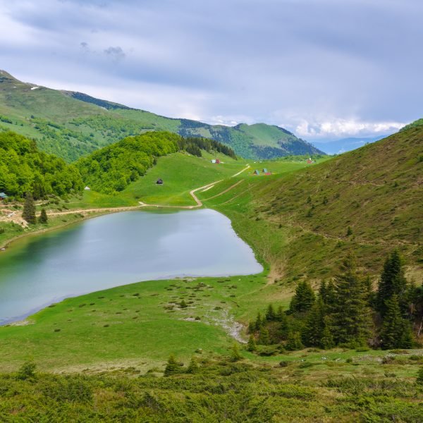
At 2.6km in the hamlet of Ćosovići we join the “real” road for Vusanje. In the second part of the tour we will come back to this junction, but now we turn right there. About 1.3km later there is a spot which, from the right is joined by an asphalt road from the village of Gerani (this is also the finishing post for Route GU 04, which goes via Ali Pasha’s Springs).
Near Vusanje (at 4.6km) the ascent becomes more intense and it will stay that way until we leave this serene, sleepy village. The asphalt road ends at the little bridge beyond the village, 5.6km from the start – we go on along a fairly good quality macadam road, with short poorer quality sections. To add a little spice to the proceedings: we are travelling along the former Peć–Skadar caravan road.
Some hundred metres after the bridge there is a place where one should definitely take a break: taking the path which forks right through a meadow, we will reach the nearby Grlja Waterfall. We can only see the waterfall as we approach something that looks like a huge stone pot, buried on the edge of a meadow. Attention: there is no barrier, and the edges of the twenty-or-so metre-deep opening are often damp, so one should be very careful.
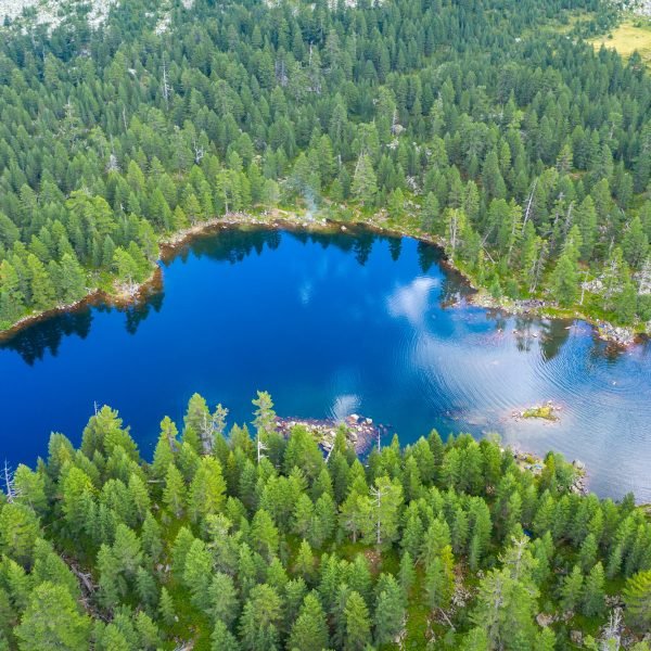
For us this water story does not end at the opening – actually, we read it starting from the middle, and only when we continue along the macadam up the valley, do we head towards its first chapter. About 2.5km upstream from the waterfall and at an elevation of 1000 metres above sea level, in the deep, blue-green, crystal clear pupil of the karst spring called Oko Skakavice (Eye of the Skakavica), the ice-cold, sharp little River Skakavica (or Skavkač) is born from the snows of the Prokletije Mountains. The spring, with a diameter of some thirty metres, is one of the most abundant in the Prokletije Mountains – in the springtime, when it is “in its stride”, it is more than 11 metres deep, capricious and panting. During the summer it calms down, waiting for the next spring and the new melting of the white fleece from the mountain’s shoulders.
In order to visit the spring, we should pay attention to the right side of the road and a rock with markings on, from where the short forest path leading there starts. And then finally one can put together the entire “biography” of the strange little River Skakavica: downstream it plunges into the opening which we have already seen, and the tormented river throws off its first name there, it persistently cuts through a short but remarkable canyon only to emerge into the light of day and reach the green pastures in the valley below Vusanje, demanding to be called Grlja. (Hidden beneath the waterfall itself, under the bubbling water at the bottom of the opening and smashed with the never-ending water bombardment, it is pulsated and fed by another gushing spring before the beginning of all that hard work). On the way to Lake Plav it changes its name again and hides in other streams several times: connecting with the water from Ali Pasha’s Springs it becomes the River Vruja, and after Gusinje, joining up with the River Grnčar, it flows to the lake as the River Ljuča.
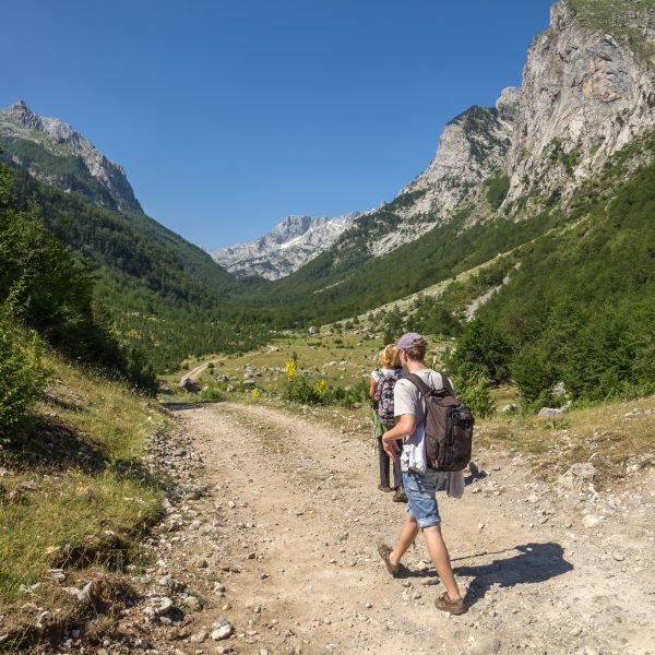
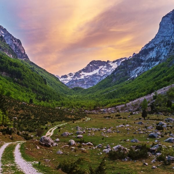
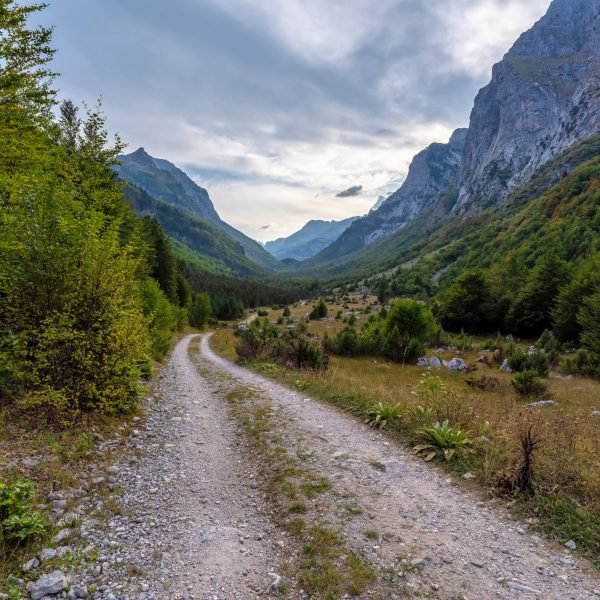
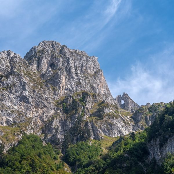
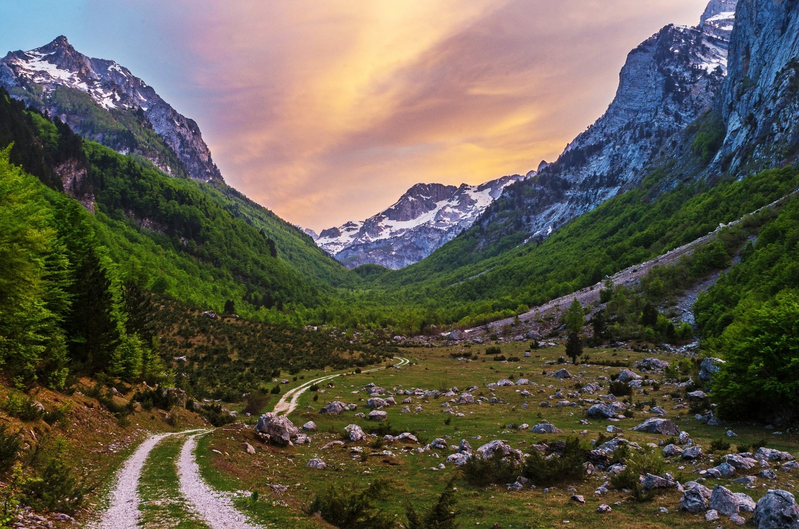
On the rest of the ascent into the upper parts of the Ropojana Valley the ascent is moderate so we will soon reach a rest stop with a wooden roof (at 7.3km). Some of the best known peaks of the Montenegrin Prokletije Mountains: Karanfili, Vezirova brada, Beljan and others rise above it. Here we also enter the territory of the Prokletije National Park which stretches all the way to Lake Ropojana, 4.5km away – which means that if we go there we will have travelled a total of 9km within the national park.
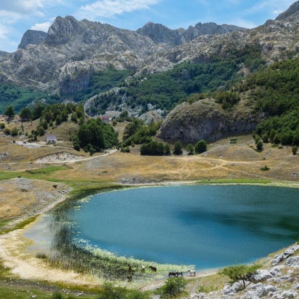
Beyond this point the valley narrows considerably and that section is very lovely, but the rest of the journey to the lake, which is located within the border area at the end of the valley, depends on the current condition of the road. During the spring it is usually destroyed by floods so it has to be fixed, but if it has not been done, one should continue on foot, since going with a bike(i.e. pushing it) would be difficult. In that case we can lock our bikes by the roofed rest stop. Near the end of the valley there is a junction with a signpost, at which a macadam road goes towards the border watchtower in Zastan (in the area of Vusanje). This is a place in which we will definitely leave our bikes – if we have succeeded in reaching this place with them – and instead of continuing along the macadam we will proceed straight on, along a path through beech forest which will bring us to Lake Ropojana (1,240m) after a walk of some fifteen minutes. In Vusanje it is also called Lake Čemerikino or Zmijsko, it is about 700m long, at most a few hundred metres wide, and up to some ten metres deep. Unfortunately, during the summer months, it dries up, but when it is there and when we glance at its emerald water, and the high, sharp teeth of Karanfili Peak rising behind, it is truly breathtaking. If we go to the lake the total length of the tour will be 23km.
Note: since this is a deserted area, when hiking in the second part of the Ropojana Valley one should always bring along a torch, a map and a navigation device (a GPS device or at least a compass), and we also recommend going there in a group. The end of the valley crosses over to Albanian territory, so the lake should be the furthermost point to which we venture.
We head back along the same route, but after Vusanje when we reach the mentioned junction in Ćosovići (at 11.9km) we will continue straight on, starting an interesting section we did not go along on the way here. Along the next 500 metres there are sections of both asphalt and fair macadam. At 12.5km on the right side of the road there is a spring, after which there is a roughly 1km-long patch of macadam. On it we will also negotiate one steep section about 200m long, which take us to the place called Krš Čekića,from where we will have a nice view of the valley of the River Vrulja and Gusinje as a reward.
Now we only have a short descent to the asphalt (at 13.4km) along which we soon reach Gusinje and end this dynamic and attractive ride.


